
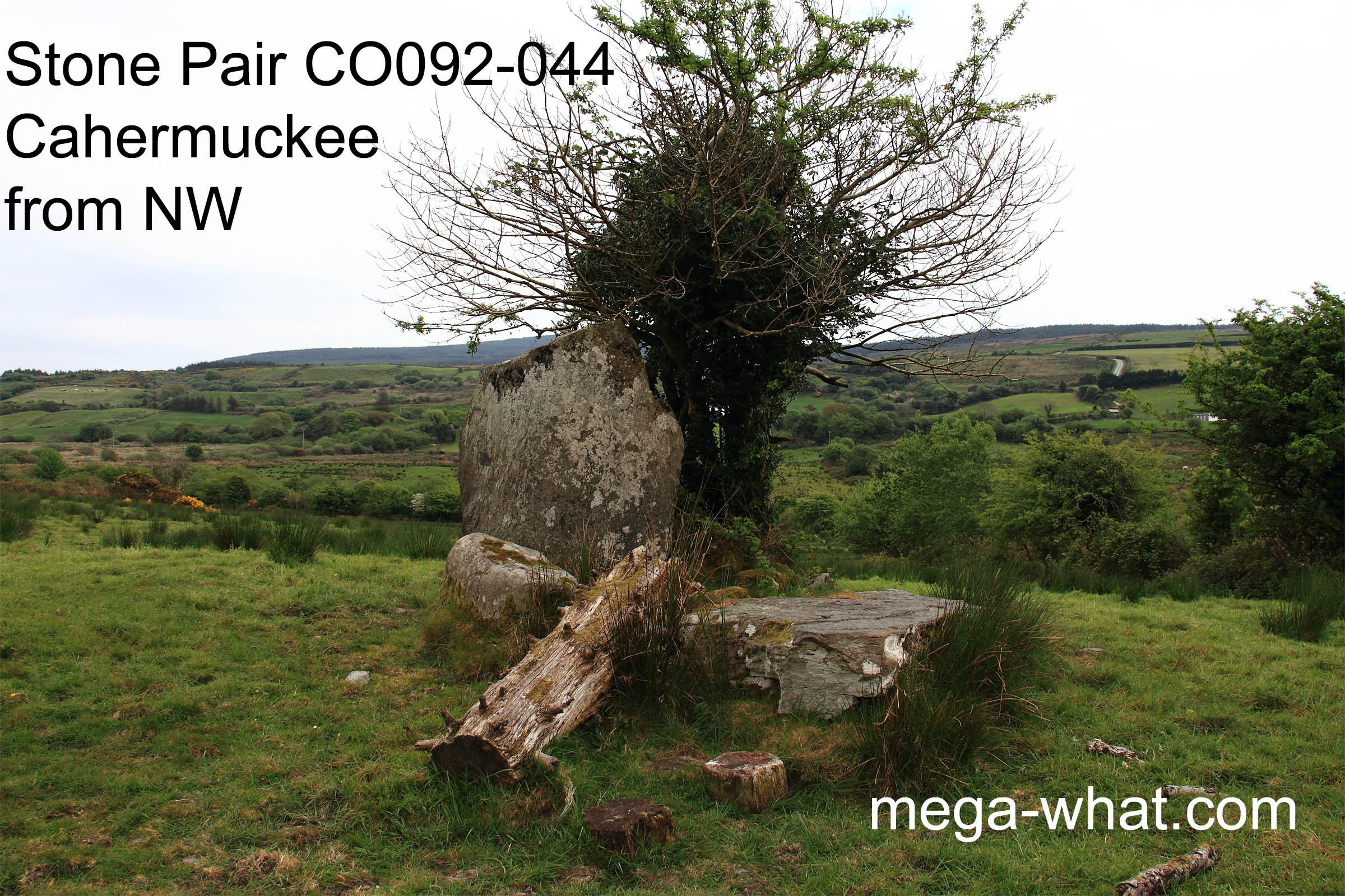
 Cahermuckee Standing Stone Pair is about 4km north-east of Kealkill. Just inside a field, off a farm track - ask permission at the farmhouse opposite the track entrance.
The taller, south-western stone is fallen and there is nowhere to stand that would bring the stones below the axial horizons.
 Views are obscured by trees in parts, especially the north-west.
South is at the basal step of a hill, on the left side of a dip between two hills [Pic].
![[Pic]](Cahermuckee-S.jpg)
North is at a step/break at the left end of the local hilltop [Pic].
![[Pic]](Cahermuckee-N.jpg)
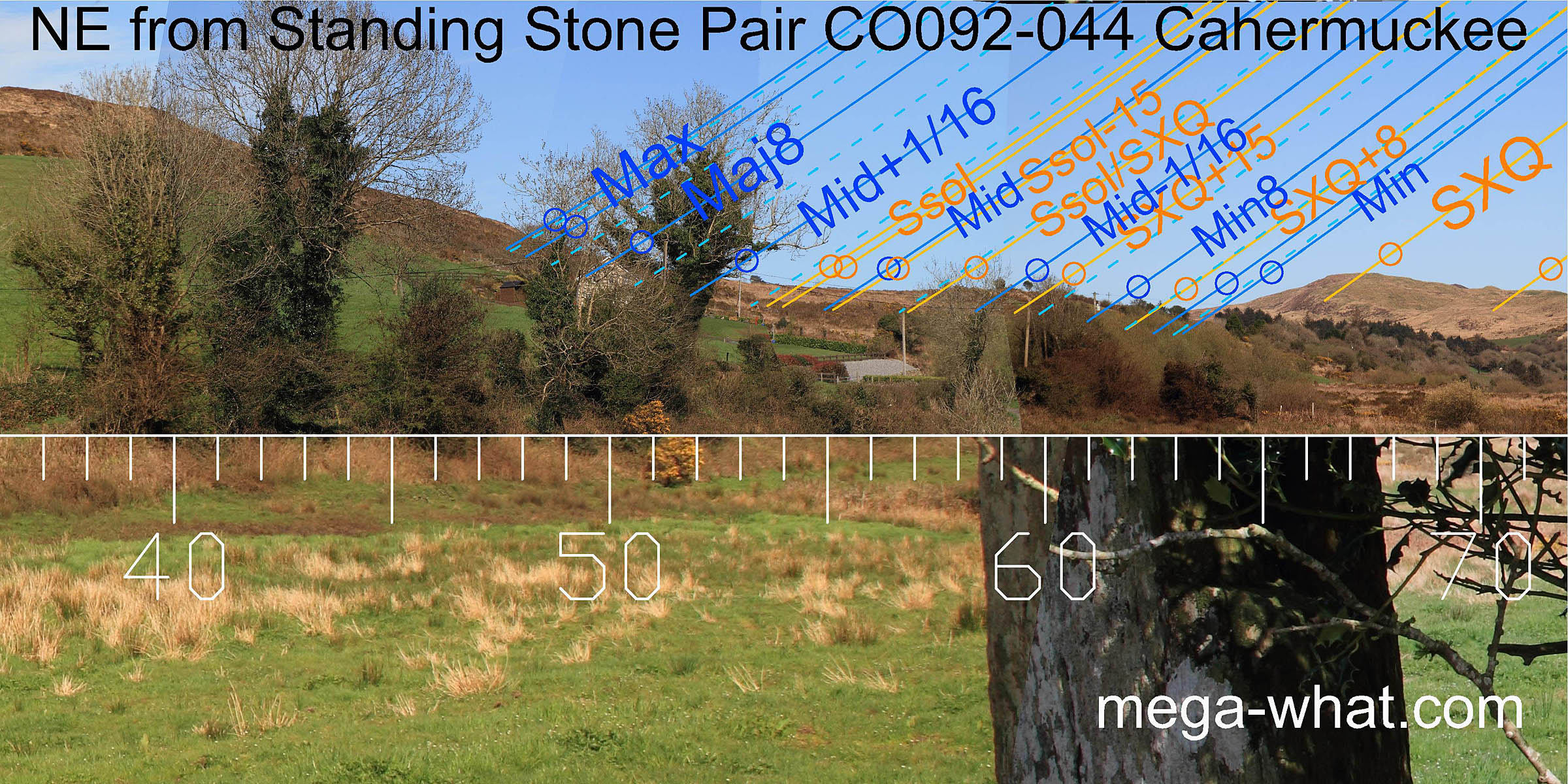 To the north-east, summer cross-quarters are on hilltop with lunar minor standstill
Lunistice positions vary cyclically over an 18.6 year period but are fairly static for more than a year at either end of the range at its northern foot.
The next bit of a dip is a half-month from summer solstice and lunar major standstill is at a break in the eastern slope of the northern hill.
With trees beside the one upright stone, the monument axis cannot be assessed accurately but is towards the minor half of the lunistice
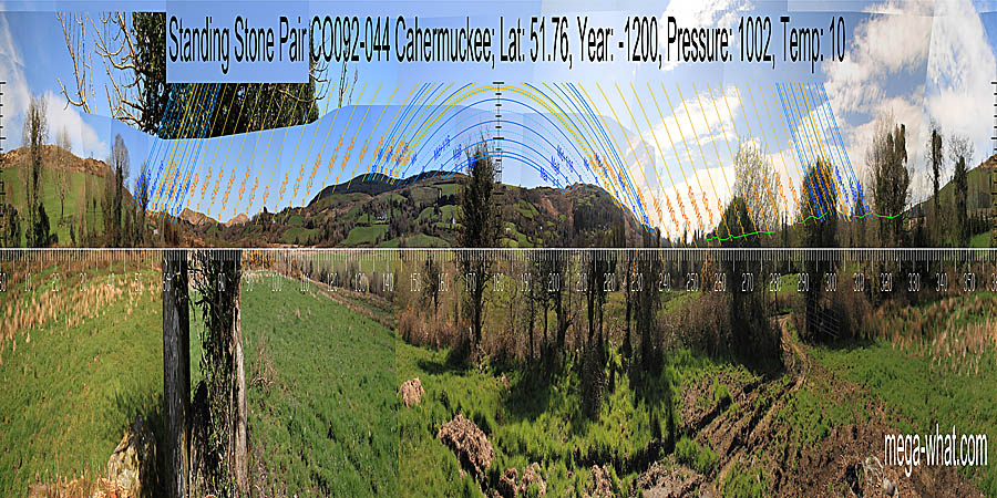
Lunistices are the most northerly and southerly moons of the month. The lunar equivalent of solstices - more. zone [Pic].
To the north-east, summer cross-quarters are on hilltop with lunar minor standstill
Lunistice positions vary cyclically over an 18.6 year period but are fairly static for more than a year at either end of the range at its northern foot.
The next bit of a dip is a half-month from summer solstice and lunar major standstill is at a break in the eastern slope of the northern hill.
With trees beside the one upright stone, the monument axis cannot be assessed accurately but is towards the minor half of the lunistice
Lunistices are the most northerly and southerly moons of the month. The lunar equivalent of solstices - more. zone [Pic].
![[Pic]](Cahermuckee-NEax.jpg)
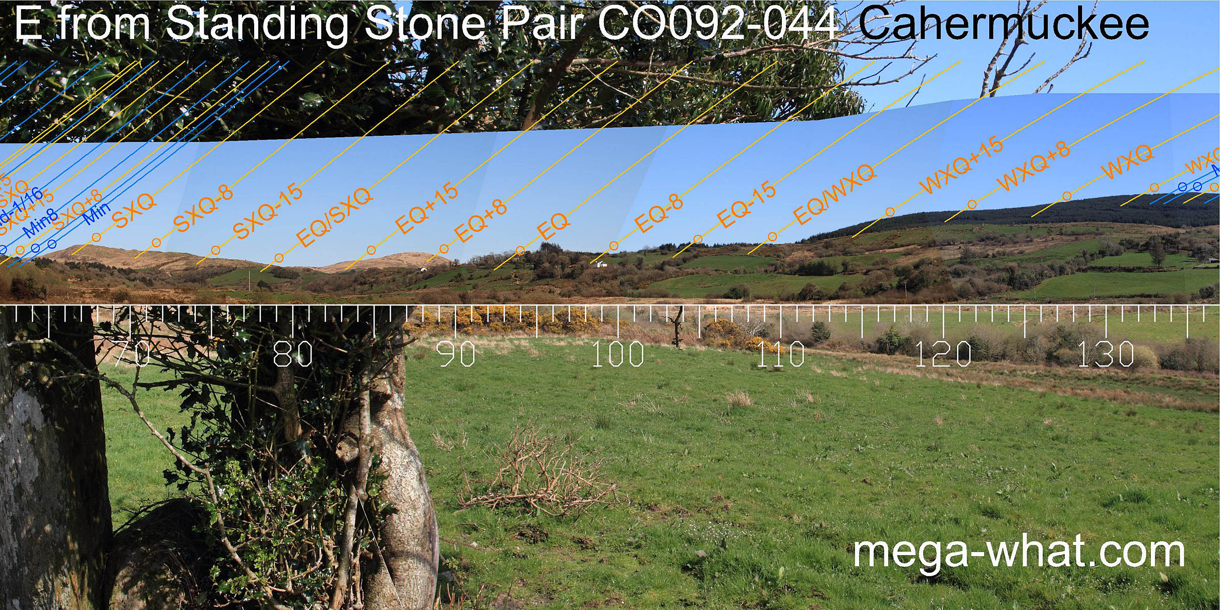 Eastwards, the equinox is on the last hill of a spur of the local ridge.
The equinox / winter cross-quarter midpoint is at the foot of a hill, as is the equinox / summer cross-quarter midpoint.
Eastwards, the equinox is on the last hill of a spur of the local ridge.
The equinox / winter cross-quarter midpoint is at the foot of a hill, as is the equinox / summer cross-quarter midpoint.
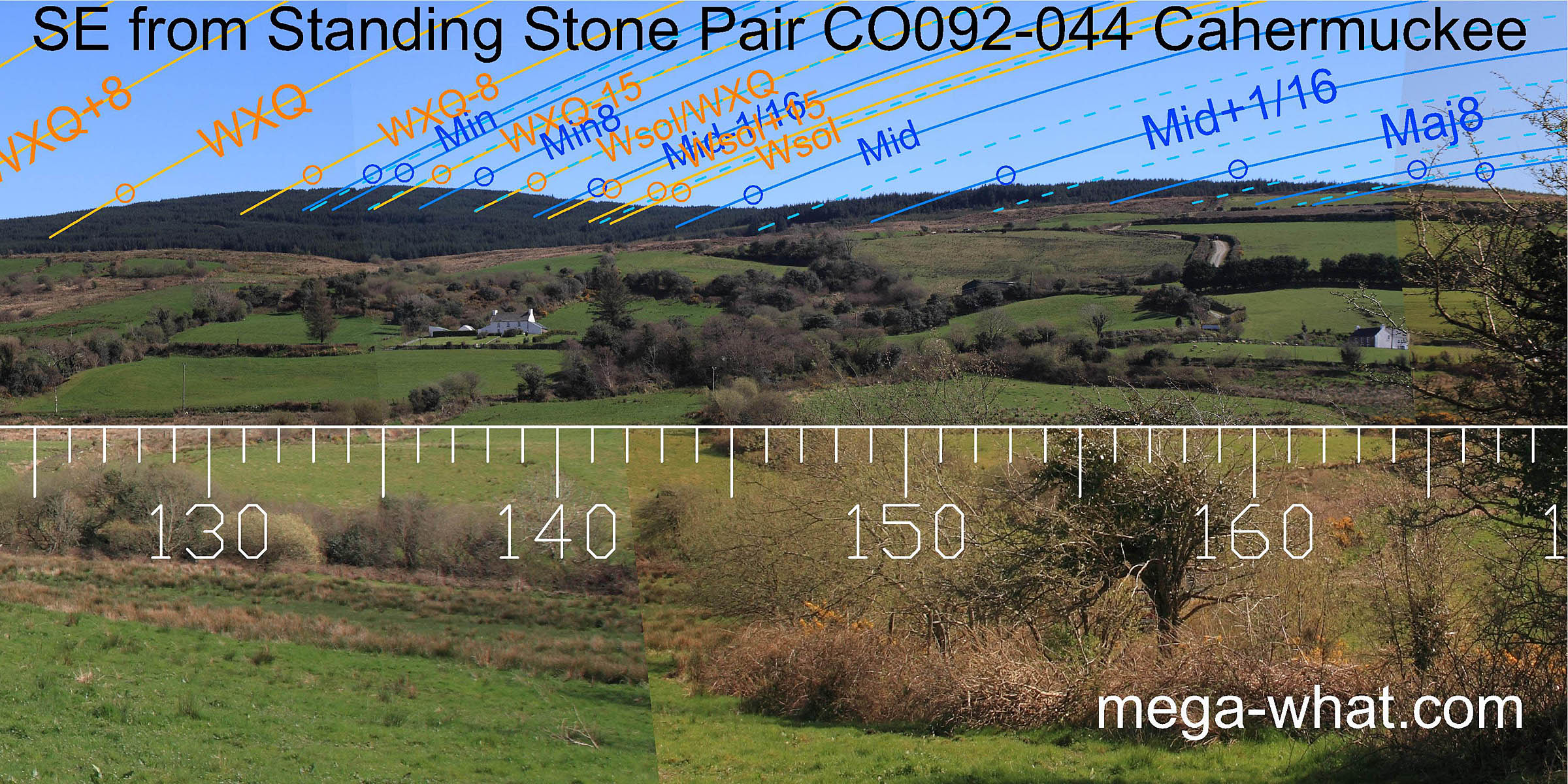 To the south-east there are two hills.
Lunar minor standstill is on the left hilltop, major standstill is at the right-hand end top of the right-hand hill and the lunar midpoint is in the central dip.
To the south-east there are two hills.
Lunar minor standstill is on the left hilltop, major standstill is at the right-hand end top of the right-hand hill and the lunar midpoint is in the central dip.
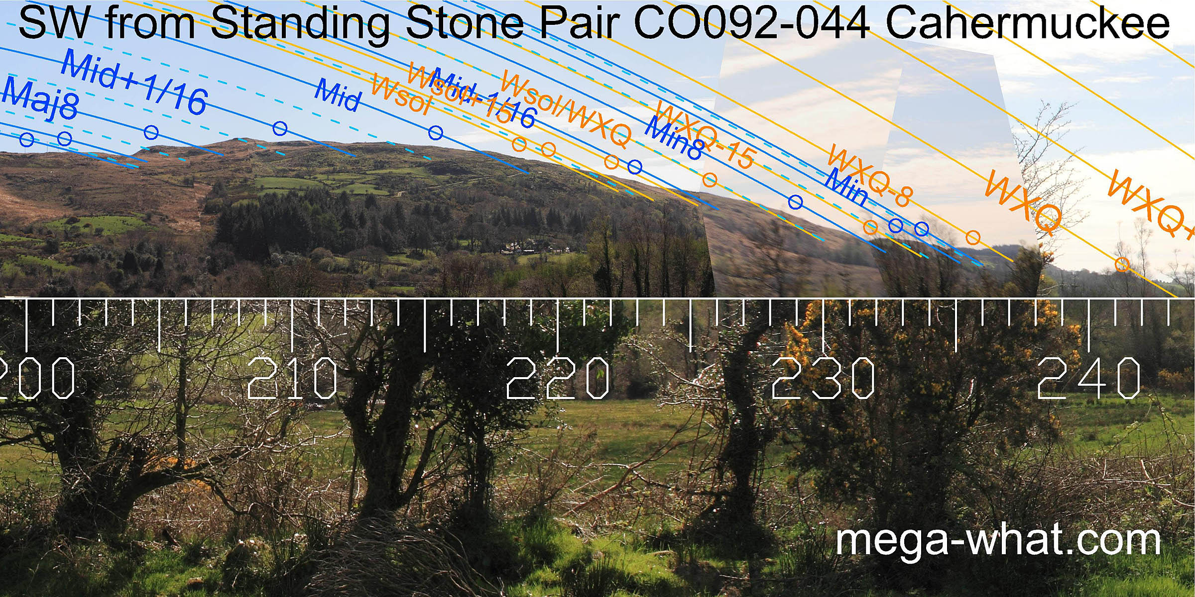 The south-west has another large hill. Major standstill is at the first top of its ridge and the lunar midpoint is at the right-hand end top of the hilltop proper.
The minor half of the lunistice zone runs down the receding western ridge with good correspondence between lunar positions and useful markers.
The sun does less well. In this direction the axis seems to be at the very minor end of the lunistice zone [Pic].
The south-west has another large hill. Major standstill is at the first top of its ridge and the lunar midpoint is at the right-hand end top of the hilltop proper.
The minor half of the lunistice zone runs down the receding western ridge with good correspondence between lunar positions and useful markers.
The sun does less well. In this direction the axis seems to be at the very minor end of the lunistice zone [Pic].
![[Pic]](Cahermuckee-SWax.jpg)
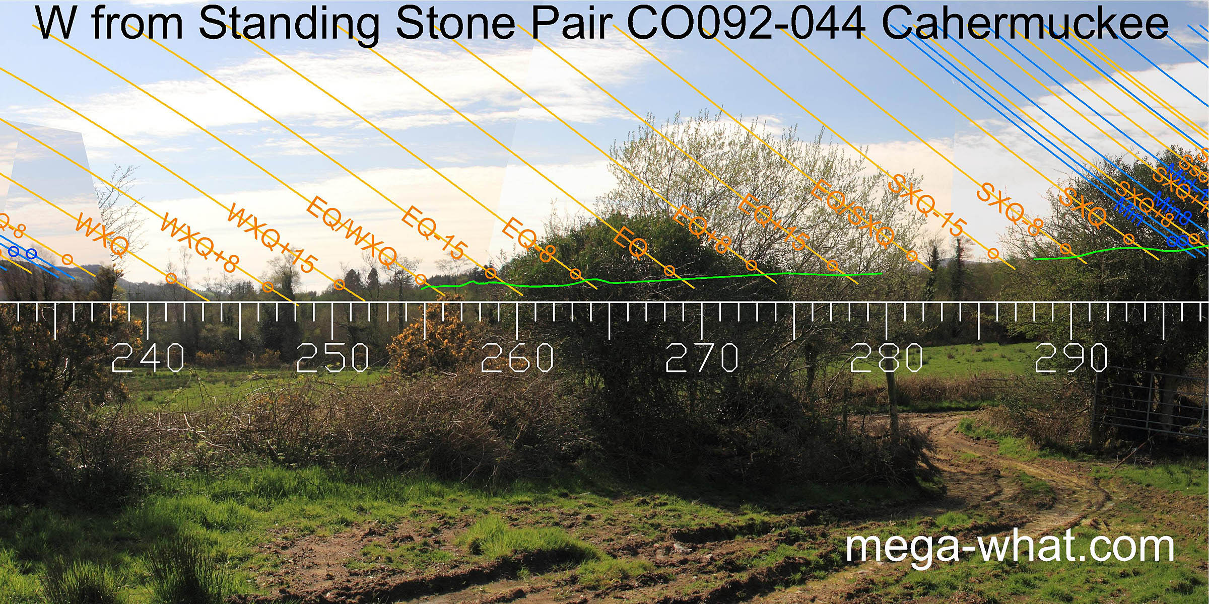 Westwards, the bottom of the dip is a week or two north of the winter cross-quarters.
Both equinox / cross-quarter midpoints may have useful markers but the trees are not helpful.
Westwards, the bottom of the dip is a week or two north of the winter cross-quarters.
Both equinox / cross-quarter midpoints may have useful markers but the trees are not helpful.
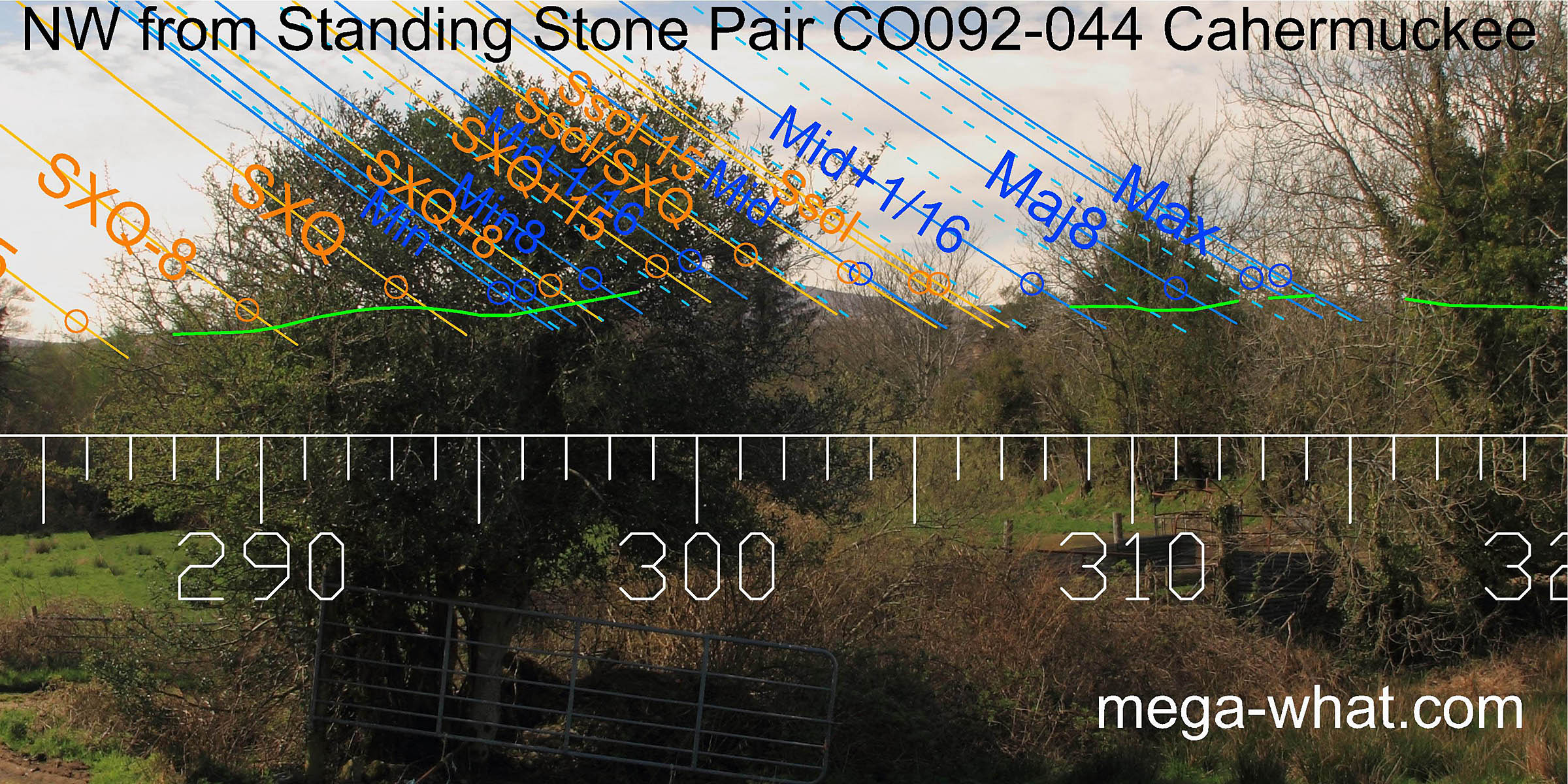 The north-west is largely obscured but summer cross-quarter seems to be marked by a hilltop with minor standstill at the following dip.
The next hilltop is half-way to summer solstice which itself is in a dip. Major standstill is on a hilltop.
The north-west is largely obscured but summer cross-quarter seems to be marked by a hilltop with minor standstill at the following dip.
The next hilltop is half-way to summer solstice which itself is in a dip. Major standstill is on a hilltop.
- Kealkill Five Stone Circle, Stone Pair & Radial Stone Cairn are c.3.3km south-west (240°) and would probably be visible from here but for some trees.
- Cappaboy Beg Stone Pair is c.3.4km north-north-east (20°)
- Gortloughra Stone Pair is c.3.6km north-east (54°)
References
- Archaeological Survey of Ireland, record details. www.archaeology.ie/archaeological-survey-ireland
- POWER, D. et al. 1992 Archaeological Inventory of County Cork, Volume 1: West Cork. Dublin: Stationary Office. p39, no.174.
- Ó'NUALLÁIN, SEÁN 1988 Stone Rows in the South of Ireland. Proceedings of the Royal Irish Academy 88c:179-256, p245, no.113.