 Ringarogy Island Passage Tomb is between Skibbereen and Baltimore.
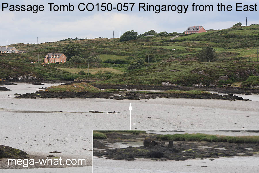
On the east shore of a small islet in a tidal area known as 'the Lag', just south of and visible from the causeway to Ringarogy Island.
When the tomb was built it would have been on dry land near the river but sea levels have risen and now it is below the high water mark.
This site demonstrates that while passage tombs are usually on high ground such a location is not a requirement. Being 11km north-east of the passage tomb at Killickaforavane on Clear Island, it had initially seemed likely that this one was here to utilise the southerly skylines not available from there but it has transpired that the equinoctial zone is the best.
South is roughly indicated by a dip [Pic].
North is in a saddle at the western side of a dip [Pic].
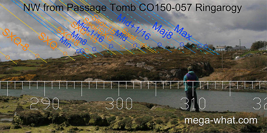
 To the north-east, summer sunrises and the entire lunisticeLunistices are the most northerly and southerly moons of the month. The lunar equivalent of solstices - more.
range spread along this low lying stretch which is rocky and bumpy enough to provide a variety of useful markers.
The lunar major standstillLunistice positions vary cyclically over an 18.6 year period but are fairly static for more than a year at either end of the range
is on a low hilltop, the minor standstillLunistice positions vary cyclically over an 18.6 year period but are fairly static for more than a year at either end of the range
is on a rocky high-point and the solstice would seem to be in a bit of a dip.
The passage axial alignment is a half-month south of the summer cross-quarters. The tall slab visible beyond the back slab is actually to the north side of the entrance [Pic].
 The hill of Knockomagh covers a period of about six weeks, from the half-month south of the equinox to the half-month south of the cross-quarter.
Trees obscure the area where winter cross-quarter and the lunar minor standstillLunistice positions vary cyclically over an 18.6 year period but are fairly static for more than a year at either end of the range
would occur.
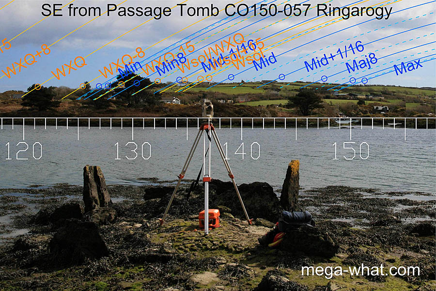
 To the south-east is a low wide hill. Its profile is fairly smooth and possible break points are obscured by buildings but the hilltop marks a lunar sixteenth.
The lunisticeLunistices are the most northerly and southerly moons of the month. The lunar equivalent of solstices - more.
range spreads up and over this hill, with the major lunar limit at an obvious break on the southern slope.
 Nearby to the south-west is a rocky outcrop and it would seem that the tomb has been sited so that it is significantly placed on the skyline.
Because it is so close, exact position is significant as may be seen from this picture.
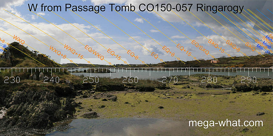
Axial reverse is two to three weeks north of the winter cross-quarters [Pic].
 The cross-quarter coincides with a dip in the distant horizon.
The half-way point between winter cross-quarter and equinox is in a dip while the half-way point between summer cross-quarter and equinox is at a 'knee' at the end of a nearer ridge.
Between them the weeks around the equinox have fairly good markers.
 The high point of the nearer ridge would seem to be a lunar sixteenth but this skyline is rather spoiled by buildings and vegetation.
Coincidence of suitable tides and good surveying conditions has not been frequent. The site is not easy to access and has only had one brief visit to date - thanks to Dave King for that.
References
- Archaeological Survey of Ireland, record details. www.archaeology.ie/archaeological-survey-ireland
- RONAN, S. et al. 2009 Archaeological Inventory of County Cork, Volume 5. Dublin: Stationary Office. p7, no.15321.
- SHEE TWOHIG, ELIZABETH 1995 An inter-tidal passage tomb at "The Lag", Ringarogy Island, Co. Cork. Archaeology Ireland Vol.9, No.4: 7-9. Bray:Wordwell.

